• Hello, please take a minute to check out our awesome content, contributed by the wonderful members of our community. We hope you'll add your own thoughts and opinions by making a free account!

Tropical Tropical Storm Bret

Webberweather53

Meteorologist
Joined
Jan 5, 2017
Messages
15,695
Reaction score
53,825
Location
Desert Southwest ?
A strong tropical wave located ~ 35W has continued to show signs of organization over the last day or so, thus the National Hurricane Center (NHC) has increased the probability of tropical cyclogenesis to 40% over the next 5 days as this wave reaches the southern Lesser Antilles, Aruba, and the northern portions of Venezuela and thus the NHC has designated it as 92L. While it's relatively low latitude, climatology (and eventually the central America monsoon gyre) is (will be) working against the development of this system, the environment ahead appears marginally conducive for gradual development of 92L, with a relatively moist environment, augmented by a tropical wave axis centered a little ahead of 92L ~45W, and low wind shear (~ 5-15 knots). However, regardless of whether TCG occurs in the next several days, 92L will more than likely become sheared apart by upper level outflow from the CA monsoon gyre over the eastern Caribbean, and canonical lower level trade wind divergence in the east-central Caribbean (wherein easterly trade winds accelerate as they're squeezed between Hispaniola, Puerto Rico, and South America and tend to preclude TCG, especially in the first half of the hurricane season). Post away!
gfs_vort850_uv200_atltropics_2.png vis-l.jpg avn0-lalo.gif
wg8sht.gif
 
I am quite surprised at this system becoming an invest, and to think another one is likely a few days away and in June too is crazy. As mentioned, it probably won't last long, but who knows if it can become a depression before hitting the unfavorable area.
 
The Intertropical Convergence zone (as depicted in the visible satellite pic in my post above by the broken band of Cb and stratocumulus extending from 92L to northern Venezuela and the CA monsoon gyre, separating the moist, tropical airmass to the south over the equatorial Atlantic and South America from the relatively more stable and dry subtropical airmass, laden with SAL) in the eastern Atlantic is very far to the north of its climatological position for this time of the year. Its already around 10 degrees north, even in a good year, it rarely reaches this latitude until at the earliest late July and early August, what we are currently seeing is extremely anomalous in that regard and may be a harbinger of things to come...
 
The Intertropical Convergence zone (as depicted in the visible satellite pic in my post above by the broken band of Cb and stratocumulus extending from 92L to northern Venezuela and the CA monsoon gyre, separating the moist, tropical airmass to the south over the equatorial Atlantic and South America from the relatively more stable and dry subtropical airmass, laden with SAL) in the eastern Atlantic is very far to the north of its climatological position for this time of the year. Its already around 10 degrees north, even in a good year, it rarely reaches this latitude until at the earliest late July and early August, what we are currently seeing is extremely anomalous in that regard and may be a harbinger of things to come...

IF this were to mean more developments further east at the expense of geneses in the western basin and assuming that most, if not all, of these would recurve safely east of the CONUS, I'd be 100% in favor of this. The fish can handle these with no problems. 2016 was way too much tropically speaking around here (worst season overall since at least 1947 and maybe since 1898 depending on how measured) though it did help me to get a new roof via insurance.
 
IF this were to mean more developments further east at the expense of geneses in the western basin and assuming that most, if not all, of these would recurve safely east of the CONUS, I'd be 100% in favor of this. The fish can handle these with no problems. 2016 was way too much tropically speaking around here (worst season overall since at least 1947 and maybe since 1898 depending on how measured) though it did help me to get a new roof via insurance.
:cool::):D
 
IF this were to mean more developments further east at the expense of geneses in the western basin and assuming that most, if not all, of these would recurve safely east of the CONUS, I'd be 100% in favor of this. The fish can handle these with no problems. 2016 was way too much tropically speaking around here (worst season overall since at least 1947 and maybe since 1898 depending on how measured) though it did help me to get a new roof via insurance.

Unfortunately, predicting the mean steering flow is often more difficult than seasonal activity. On one hand, while tropical cyclones develop further east during La Ninas, the mid-latitude westerlies are weaker and occasionally omnipresent with large-scale ridging favored near eastern North America and Atlantic Canada that thus can direct the storms that do develop closer to the US coastline, while in El Nino the inverse is generally more applicable with storms developing closer to land but the steering pattern being generally unfavorable with stronger than normal mid-latitude westerlies and troughiness near or just off the eastern seaboard that increases the probability for recurving TCs.
 
While the ECMWF tends to be the highest performing global model and tends to perform very well in handling TC activity, it's struggling immensely with 92L in the short range. For example, the low level vorticity associated w/ 92L is verifying considerably stronger and more consolidated than forecast in the ECMWF, indicative that this disturbance is able to more readily generate and concentrate moderate-deep convection around its parent, broad area of low pressure still embedded within the monsoon trough. Although this model currently shows no TCG of 92L before running into Aruba and Venezuela, this may change if current short term trends continue.
output_FC892o.gif
 
While the ECMWF tends to be the highest performing global model and tends to perform very well in handling TC activity, it's struggling immensely with 92L in the short range. For example, the low level vorticity associated w/ 92L is verifying considerably stronger and more consolidated than forecast in the ECMWF, indicative that this disturbance is able to more readily generate and concentrate moderate-deep convection around its parent, broad area of low pressure still embedded within the monsoon trough. Although this model currently shows no TCG of 92L before running into Aruba and Venezuela, this may change if current short term trends continue.
View attachment 593
Webb,
The FL boy in me thinks that thing will get some legs ...
Phil

Also, just FWIW and not a single ¢ more: http://www.southernwx.com/community/threads/global-model-runs-discussion.196/page-3#post-31834
 
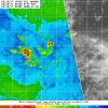
92L certainly looks like it's already very close to becoming a tropical depression already and I would anticipate it's chance for development to increase yet again at 8pm. Microwave imagery reveals a very impressive brightness temperature ring (in red) around the northern semi-circle of it's concomitant area of low pressure and is also where the deepest convection currently presides.
19369485_1435890173160968_515549659_n.png
 
92L certainly looks like it's already very close to becoming a tropical depression already and I would anticipate it's chance for development to increase yet again at 8pm. Microwave imagery reveals a very impressive brightness temperature ring (in red) around the northern semi-circle of it's concomitant area of low pressure and is also where the deepest convection currently presides.
View attachment 594
Your knowledge and my gut (coupled with the little bit I know having studied 'Canes for oh so many years) are in sync, my Man!
Thanks, Webb!
Phil
 
92L certainly looks like it's already very close to becoming a tropical depression already and I would anticipate it's chance for development to increase yet again at 8pm. Microwave imagery reveals a very impressive brightness temperature ring (in red) around the northern semi-circle of it's concomitant area of low pressure and is also where the deepest convection currently presides.
View attachment 594
Looking at the infrared satellite, I can see the circulation as well as the amount of clouds looking a lot like a nearly organized system. It could very well be close to a depression.
 
I will not be blasphemous nor will I be a Benedict Arnold, and I confess these did come from the "dark side", but here are current maps (source cropped) that are, I suppose, worth sharing:

Screen_Shot_2017-06-16_at_6.35.27_PM.png


Screen_Shot_2017-06-16_at_6.35.59_PM.png
 
GFS says tropical storm by the Lesser Antilles.
gfs_mslp_wind_92L_15.png
GFS looses it right after, but that means nothing this far out ... great catch FS!
Just hope "it" 's a fish ... as with the rest of 'em, unless they come on shore with minimal winds and bountiful rain, all season ....
 
The euro's short range struggles w/ 92L continue, yet again its vorticity max verifies stronger than forecast and this results in a solution in that features a much more well defined tropical wave axis entering the southern Antilles... Definitely took a step towards the GFS and parallel GFS.
ecmwf_mslp_uv850_atltropics_5.png
ecmwf_mslp_uv850_atltropics_4.png
 
Back
Top