Downeastnc
Member
Guess its never to early....more likely to get a tropical system in Jan than snow it seems lol....
Northwestern Atlantic:
A non-tropical low pressure system centered over the northwestern
Atlantic Ocean about 300 miles north of Bermuda is producing
storm-force winds. Although the cyclone is producing some
thunderstorm activity near the center, it is embedded in a cold air
mass with nearby frontal boundaries. The low is expected to move
northeastward today and northward tonight, bringing the system over
much colder waters and across Atlantic Canada by early Tuesday.
Therefore, it is unlikely that the low will transition to a
subtropical or tropical cyclone. Nevertheless, the system is
expected to remain a strong non-tropical low during the next day or
so, and additional information, including storm-force wind warnings,
can be found in High Seas Forecasts issued by the National Weather
Service.
No additional Special Tropical Weather Outlooks are scheduled for
this system. Regularly scheduled Tropical Weather Outlooks will
resume on May 15, 2023, while Special Tropical Weather Outlooks will
be issued as necessary during the off-season.
* Formation chance through 48 hours...low...near 0 percent.
* Formation chance through 5 days...low...near 0 percent.
I mean sure looks better than half the garbage they named last season lol
 www.foxnews.com
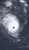
VERY ImpressiveImpressive
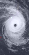
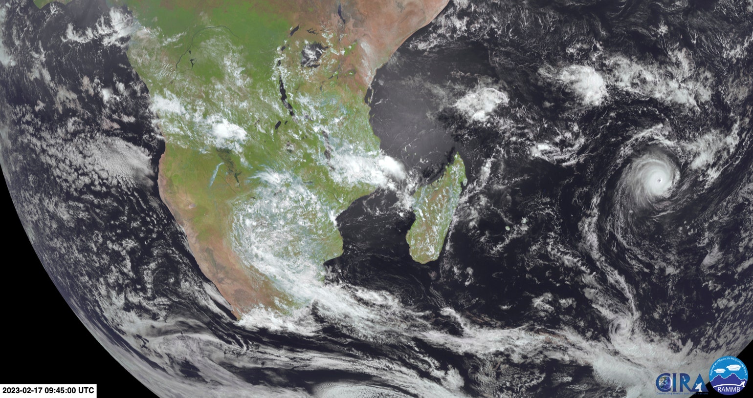
Being the weather nerd I am I am still following Freddy and he is forecast to be a 95kt cane at landfall 3. or 4. days. Then the gfs stallshim again turns him south and again redevelops him as he then races southeast clipping the SW coast of Madagascar as a mid 980s hurricane again. What a crazy storm to follow