Since people are talking about it here you go.
-
Hello, please take a minute to check out our awesome content, contributed by the wonderful members of our community. We hope you'll add your own thoughts and opinions by making a free account!
You are using an out of date browser. It may not display this or other websites correctly.
You should upgrade or use an alternative browser.
You should upgrade or use an alternative browser.
Pattern February 2024
- Thread starter SD
- Start date
weatherfide
Member
- Joined
- Jan 5, 2017
- Messages
- 3,076
- Reaction score
- 4,498
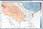
As I said in the January thread. There’s nothing wrong with that look. It’s a smoothed out mean. You can still see the strong signal for a tall western ridge better positioned and good confluence over the northeastView attachment 142659Looks "meh" on the GEFS at 06Z 1/16/2024 to start off the month. Let's see where it goes from here!
NCSNOW
Member
- Joined
- Dec 2, 2016
- Messages
- 9,186
- Reaction score
- 18,036
February and March of 2014 where two great months in Greensboro wx history. Had countless events, especially March. Racked up 16 total inches just off those 2 months. I believe 2014-2016 we where in a long, pretty strong el Niño. I stand to be corrected. That Jan was very similar to this one. Surprisingly Gboro has had 2 separate cases of a Trace of Snow logged in the books in Jan 2024. Anyway, I think there have been something like 30 el ninos since 1900 and like 5-6 registered as strong. The 2014-2016 is one of them. So who knows. Just trying to find some nuggets. We will have a pretty good idea once we flip the calendar on 2/1 and are able to see 15 days out on the models how things are gonna shake out. I'm really rooting for a tall western ridge to get set up right on the money and stay locked in. That want guarantee anything, but will give us way better odds to get other factors that come along to work in our favor. Its the #1 item I root for and look for pattern chasing, even before I glance up in the NW Atlantic.
MichaelJ
Member
February will likely be a month where we see saw from cold periods to mild ones and will average slightly below normal overall. I do think with the swings of the temperatures it will lead to more cyclogenesis coming through from California to Texas and then across the gulf states and, hopefully, they will come during the cool spells and we can score a winter storm or two. With the shorter wave lengths and an active SJT, we are bound to see a threat during the month for the entire SE but I would not bet a lot of money on it being all snow.
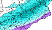
Buddy I will take that with happiness and say bring on spring.First call fro-model run for the week 1 Feb winter storm View attachment 142694
NoSnowATL
Member
We all would take that.First call fro-model run for the week 1 Feb winter storm View attachment 142694
8-10 for me. Too low. Toss.We all would take that.
griteater
Member
griteater
Member
13-14 NeutralFebruary and March of 2014 where two great months in Greensboro wx history. Had countless events, especially March. Racked up 16 total inches just off those 2 months. I believe 2014-2016 we where in a long, pretty strong el Niño. I stand to be corrected. That Jan was very similar to this one. Surprisingly Gboro has had 2 separate cases of a Trace of Snow logged in the books in Jan 2024. Anyway, I think there have been something like 30 el ninos since 1900 and like 5-6 registered as strong. The 2014-2016 is one of them. So who knows. Just trying to find some nuggets. We will have a pretty good idea once we flip the calendar on 2/1 and are able to see 15 days out on the models how things are gonna shake out. I'm really rooting for a tall western ridge to get set up right on the money and stay locked in. That want guarantee anything, but will give us way better odds to get other factors that come along to work in our favor. Its the #1 item I root for and look for pattern chasing, even before I glance up in the NW Atlantic.
14-15 Weak El Nino
15-16 Super El Nino
griteater
Member
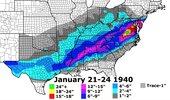
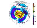
LOL 1935-1936 sameThe 1940 composite is that of fiction....I'm fairly certain this was on a different Earth in the multi-verse.
View attachment 142697
griteater
Member
That Jan 1940 map from Kylo is utter perfection
It think I saw this on more than a few EPS and Weekly maps this year.That Jan 1940 map is utter perfection
buckinbronco
Member
Everyone knows Jan 1940 was faked just like the moon landingThe 1940 composite is that of fiction....I'm fairly certain this was on a different Earth in the multi-verse.
View attachment 142697
I blame the TickTock for us not being able to repeat that type pattern.That Jan 1940 map from Kylo is utter perfection
I'll go with 2014 February that's when I had my all time biggest snow 19 inches, that def band was something else 4 inches an hour for a few hours. It snowed like 8 inches overnight and def band came through that morning and dropped 11 inches in 4 hours it was amazing...
Dang that's a lot of rain.First call fro-model run for the week 1 Feb winter storm View attachment 142694
griteater
Member
That was the one where I was out of town on business in Detroit lol, ugh. They got a foot at home with big finish / big flakes that morning like you mention. That storm had huge potential out in the piedmont too, but Raleigh kind of got in on the early overrunning wave of the storm (photo of fire and cars wrecked everywhere), and western piedmont got hit harder with the 2nd wave of the trailing upper low moving in. Needed to have those 2 sync upI'll go with 2014 February that's when I had my all time biggest snow 19 inches, that def band was something else 4 inches an hour for a few hours. It snowed like 8 inches overnight and def band came through that morning and dropped 11 inches in 4 hours it was amazing...


