Bama Ravens
Member
Not an especially significant threat, but worth starting a thread.
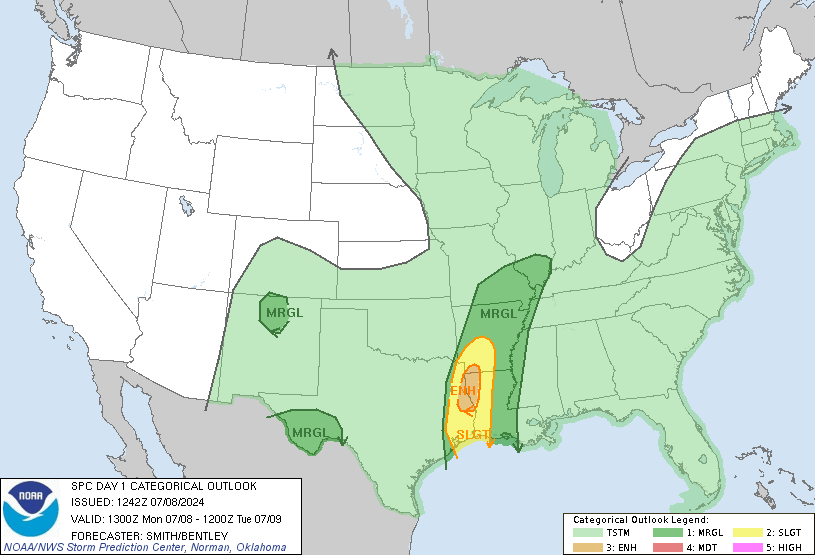
Mid-South into the Southeast...
Present indications suggest that isolated to scattered elevated
thunderstorms may develop late this afternoon into the early evening
ahead of the front across the Mid-South as large-scale ascent
associated with the upper trough overspreads this region. This
initial activity may pose a marginal risk for hail, as 850-500-mb
lapse rates around 6.5-7.0 degrees C/km support elevated instability
generally ranging from 500-1000 J/kg.
Low to mid 60s surface dewpoints will likely be in place ahead of
the cold front by this evening across the Mid-South and lower MS
Valley. Convection should initiate across the lower MS Valley around
03-05Z with the arrival of the front. Forecast soundings from the
NAM, RAP, and HRRR indicate generally southwesterly low-level winds
veering to westerly and strengthening at mid levels. The strength of
the low-level winds and linear forcing along the front suggest
strong to locally damaging wind gusts may occur with bowing line
segments from late this evening into the overnight hours across the
lower MS Valley into the Southeast.
There may also be some marginal potential for a tornado or two with
this evening/overnight activity, as sufficient veering of winds in
the low levels combines with modest instability to support some
updraft organization and near-surface-based effective inflow
parcels. This threat is conditional on a favorable storm mode,
namely supercells developing along/ahead of the front, which is
uncertain. The overall severe threat should wane late tonight across
the Southeast as the cold front undercuts convection, the boundary
layer gradually stabilizes, and large-scale forcing for ascent
becomes increasingly displaced to the north.