Webberweather53
Meteorologist
The strength of the blocking high over Greenland on this GFS run is despicable...
About 520 meters above normal...

About 520 meters above normal...

And this ugly ridge over the east, is ahead of the pattern change??The strength of the blocking high over Greenland on this GFS run is despicable...
About 520 meters above normal...
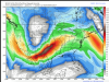
View attachment 1584
And this ugly ridge over the east, is ahead of the pattern change??


january 1977 was a damn great winter here west tn...... we got 5 nice big snows that winter... almost one per week... kind remind me of winter 85 almost in snow totals whole winterDefinitely headed in the right direction. If this pattern materializes, then we will have a great start to winter. January of 1977 was cold, but it was also very suppressed. I can remember snow in Miami that year. January of 2003 was the year that a clipper dropped 8.5 inches of snow here due to incredible ratios. Let's not forget the Christmas snow in 2010. We all know what happened in March of 1960. I would say that the projected pattern would deliver the goods. Now, all we have to do is keep that look until verification time.
that was me you eluded to webber... yes i notice on that run... could be a big severe event setting up put ahead big pattern changeAs I alluded to another poster this morning, if this initial surge of cold air were to be directed into the western US or Rockies, we could be looking at a pretty good shot for some severe weather anywhere from the south-central Plains, lower-mid Mississippi Valley to Dixie Alley on the leading edge of this arctic air & this is exactly what the GFS is advertising by day 8-9. It's pretty normal for a big Colorado Low/Panhandle Hook storm to occur during the transition period between these major regimes and I wouldn't be shocked if that's the first major storm system that we have to contend with later next week...
View attachment 1589
View attachment 1587
")
The 0Z GEFS is predicting for 12/10
that the PNA will approach +1, the AO -3, and the NAO -1. Since 2000, I have found only 4 periods during DJF with this or near this combo (SE wx noted):
- part of Jan of 2016 (nothing notable)
- good portion of Jan-Feb 2010 (great cold/wintry period overall)
- early Dec of 2002 (cold and around time of devastating Carolina icestorm)
- late Dec of 2000 (quite cold with some wintry) (Dec of 2000 is a top analog as mentioned)

Lord,
There's something wrong with this, unless ...
... a pattern change is coming ...

I think me and you will get a MAJOR icestorm this winter. Just as bad or worse than Dec 2002 and 2005. Another area to watch is north Mississippi and western Tenn.Definitely headed in the right direction. If this pattern materializes, then we will have a great start to winter. January of 1977 was cold, but it was also very suppressed. I can remember snow in Miami that year. January of 2003 was the year that a clipper dropped 8.5 inches of snow here due to incredible ratios. Let's not forget the Christmas snow in 2010. We all know what happened in March of 1960. I would say that the projected pattern would deliver the goods. Now, all we have to do is keep that look until verification time.
as much as i love snowstorms, i also love good icestorms as well. Icestorms will be something to watch for sure.I think me and you will get a MAJOR icestorm this winter. Just as bad or worse than Dec 2002 and 2005. Another area to watch is north Mississippi and western Tenn.
I consider my "hometown" Memphis/Germantown (lived there from '77 thru '86) - great memoriesjanuary 1977 was a damn great winter here west tn...... we got 5 nice big snows that winter... almost one per week... kind remind me of winter 85 almost in snow totals whole winter
Let’s just hope if we do get one in North MS it isn’t a ‘94 redo.I think me and you will get a MAJOR icestorm this winter. Just as bad or worse than Dec 2002 and 2005. Another area to watch is north Mississippi and western Tenn.
Yep, can get big storms during pattern changes, usually liquid though, as pattern changes to cold.12z EPS control has a ZR/sleet to a snow event for most of the SE from the 6th to the 8th or so time period. The GFS has been hinting at something wintry as well at some point during the upcoming cold pattern.
Sent from my SM-J327T1 using Tapatalk